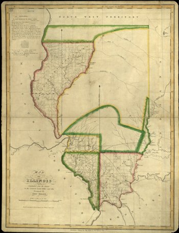
1818 Statehood Map
There are only four surviving copies of this 1818 map of Illinois, which was printed in Philadelphia. John Melish produced it from surveys in the General Land Office and a few other sources. Produced only a few months before Illinois achieved statehood, the map reflects the priorities of early settlement, highlighting military bounty lands granted to War of 1812 veterans in color. Note, too, that the northern border does not yet reach Lake Michigan. This conformed to the original statehood bill placed before Congress, but Illinois’ Congressional delegate, Nathaniel Pope, quickly moved for an amendment to extend the border about sixty miles further north. Pope wanted to ensure his new state included ample room for a port city (what would become Chicago) and access to the lead mines around modern Galena. Congress approved, although debate with Wisconsin over the border continued well into the 1840s.


